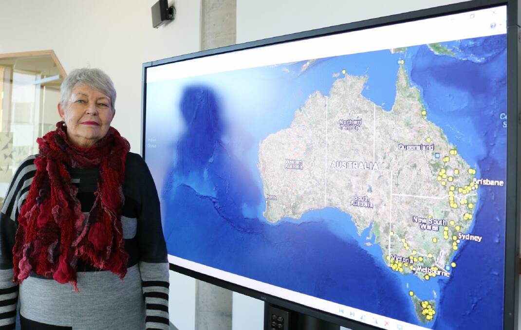
An online mapping project plotting Australia’s colonial wars has already pinpointed some 150 massacres.
Subscribe now for unlimited access.
or signup to continue reading
The project currently lists massacres from 1788 to 1872, predominately on the eastern seaboard. Included in the data is information including coordinates, local photos, the motive (where known), details of when each started and ended, the clan or nation and the source of the information.
Developed by University of Newcastle historian, Professor Lyndall Ryan, a member of the centre for 21st century humanities and the centre for the history of violence, the map is a significant step in the recognition of the periods of violence in Australia’s history.
“The biggest argument in the scholarship of massacre is ‘how do we know it happened?’” Professor Ryan said.
“Most massacres took place in secret and were designed to not be discovered, so finding evidence of them is a major challenge. This digital tool brings significant historical information out of the depths of archives, bringing it to life in an accessible and visual format.
“With this map we’ve developed a template to identify massacres and a process to corroborate disparate sources. They include settler diaries, newspaper reports, Aboriginal evidence and archives from state and federal repositories.
“The map pulls the sources together to form a coherent list of frontier massacres spanning 80 years across eastern Australia.”
It has been a four-year process to map the frontier massacres in eastern Australia, a project funded by an Australian research council (ARC) grant investigating violence on the Australian colonial frontier, 1788-1960.
Professor Ryan said there were similar maps online however this was the first one that detailed the sources of evidence of the massacres and would be a useful tool for history students, scholars and the general public.
“So far we have mapped Tasmania, Victoria, most of NSW and Queensland and have about 150 massacres listed at present. It’s likely to end up being more than 200 across an 80-year period from settlement to 1872 as we progress the map further.
At present it’s a preliminary list as we expect to find more massacres as people come forward with more evidence.
- Professor Lyndall Ryan
“There were more than 60 massacres in Victoria across 15 years; and 30 massacres along the NSW/Queensland border between 1840 to 1850. The map shows there were very intense periods of violence in particular regions. We are still working on mapping the rest of Australia and hope to have that complete within two years.”
The website is also a contact point for the public to contribute historical information they may have about massacres to the project.
“At present it’s a preliminary list as we expect to find more massacres as people come forward with more evidence,” Professor Ryan said.
“International scholars have found because massacres tend to be carried out in secret, it’s hard to get reliable information at the time it happens. Often the best information comes out later when people speak out when they know they’re not going to be killed for talking about it.
“In Australia very few perpetrators were brought to justice. I’m a historian so it’s not my intention to bring people to justice with this map.
“However, we do know the impact of massacre reverberates across the generations. When I visit Aboriginal communities today the first thing they do is take you to the massacre site,” Professor Ryan said.
An Upper Macleay River massacre in 1845 saw six aboriginal people killed from the Thungutti clan while at Towel Creek a similar number were killed in 1856. In total, five massacres of Aboriginals on the Mid-North Coast are recorded on the map.
There have long been strong suggestions of an Aboriginal massacre at Blackmans Point around the timeframe of the colonial frontier massacres data, but this does not form part of the online map at this stage.
For the full map by the Centre for 21st Century Humanities and the Centre for the History of Violence, visit https://c21ch.newcastle.edu.au

